Hallasan Hiking Guide 2026: All 4 Routes Compared (Reservation Required)
Hallasan is Korea's tallest mountain and the only place outside the Andes you can hike a 2,000m volcanic peak in 5 hours. The summit (1,947m) hosts a crater lake, the surrounding national park is a UNESCO Biosphere Reserve, and on a clear day you can see Mt. Halla from anywhere on the island. There are four official hiking routes, two of which lead to the summit and two of which don't. This guide ranks them by what you actually want from a Hallasan hike.
Find accommodation around here. Browse Jeju hiking tours here.
Reservation System (Required for Summit Routes)
To preserve the summit ecosystem, Korea National Park Service caps daily hikers on the two summit routes:
- Seongpanak: 1,000 hikers per day
- Gwanumsa: 500 hikers per day
- Yeongsil and Eorimok: No reservation required (don't reach summit)
Reservations open 1 month ahead at visithalla.jeju.go.kr. Free, but the system is in Korean — many international visitors book through their hotel concierge or a guide. The reservation is for a specific date and trail, non-transferable.
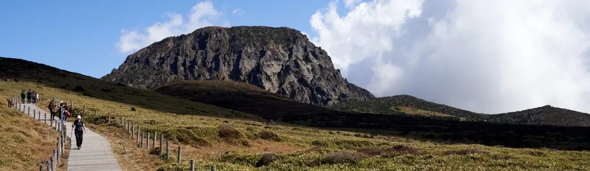
1. Yeongsil — Best Views, Doesn't Reach Summit
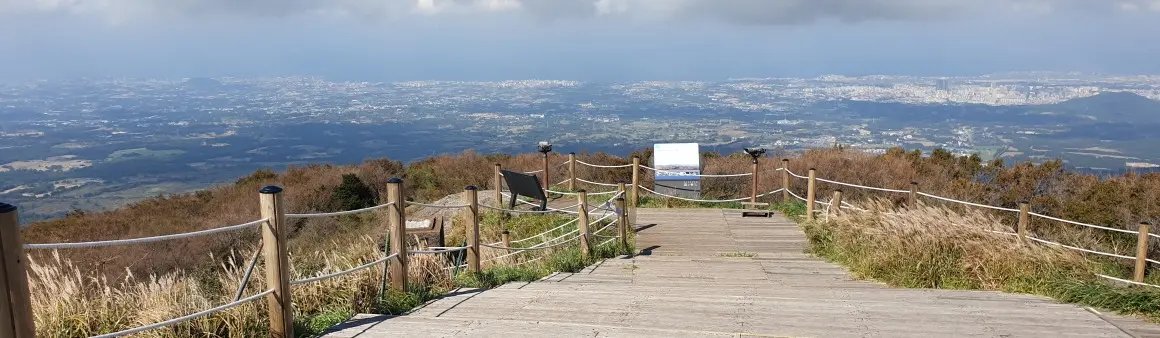
The most beautiful Hallasan hike, and you don't even need a permit. Yeongsil's signature feature is the Yeongsil-giam — a wall of 500 jagged rock pillars (the "spirit's chamber") rising out of the forest. Higher elevations open onto rolling alpine meadows that look like Scotland. The route ends at Witseoreum Shelter (1,700m) — about 250m short of the summit.
- Distance: 5.8km one-way (round trip ~11.6km)
- Time: 4–5 hours total
- Difficulty: Moderate
- Reaches summit: No
- Permit needed: No
2. Eorimok — Easiest, Doesn't Reach Summit
The gentlest Hallasan hike — gradual, well-maintained, much of it on wooden boardwalks through dense forest. Connects to Witseoreum Shelter (the same endpoint as Yeongsil), which means you can do an Eorimok-up / Yeongsil-down combination if you have a driver to shuttle you between trailheads.
- Distance: 6.8km one-way (round trip ~13.6km)
- Time: 4–5 hours total
- Difficulty: Easy
- Reaches summit: No
- Permit needed: No
3. Seongpanak — Longest, Reaches Summit
The most popular summit route. Mostly gradual through forest, with the final 1.5km steepening sharply. Wider and more developed than Gwanumsa. The summit caldera (Baengnokdam Crater Lake) is the payoff — most people spend 30–40 minutes at the top.
- Distance: 9.6km one-way (round trip ~19.2km)
- Time: 8–9 hours total
- Difficulty: Hard (long but not technical)
- Reaches summit: Yes
- Permit needed: Yes — book ahead
- Last entry: 12:30pm to start (must finish by sunset)
4. Gwanumsa — Hardest, Reaches Summit
The cult-classic Hallasan hike. Steeper, more technical, fewer people. Best for views (passes near Tamna Peak's famous "stone forests"). Many hikers do Gwanumsa up + Seongpanak down for the best of both — but you need a driver to handle the trailhead shuttle since they're 30 minutes apart.
- Distance: 8.7km one-way (round trip ~17.4km)
- Time: 8–10 hours total
- Difficulty: Very hard (steep, sustained)
- Reaches summit: Yes
- Permit needed: Yes — limited to 500/day
- Last entry: 12pm to start
Getting to Each Trailhead
None of the trailheads are walkable from public transit. Three options:
| Option | Cost | Notes |
|---|---|---|
| Rental car | ₩50,000–80,000/day | Most flexible. Free parking at all 4 trailheads. |
| Local bus 240/281 | ₩1,500 | Slow (90 min from Jeju City), limited frequency, but doable for Eorimok and Yeongsil. |
| Hiking taxi / day tour | ₩100,000–180,000 | Includes pickup, drop-off, and lunch. Some operators arrange the permit. |
Where to Stay (Pre-Hike)
- Jeju City: Closest base for Eorimok, Yeongsil, and Gwanumsa trailheads. 30–45 min drive.
- Seogwipo: Closer for Seongpanak. 35 min drive.
- Trailhead lodges: A few small pensions near Eorimok / Seongpanak — book ahead, very limited capacity.
Search Jeju City hotels here, or compare prices here.
Practical Tips: Gear, Weather, Timing
- Layers. Even in summer, summit temperatures can be 10°C+ colder than the trailhead. In winter (Dec–Feb), expect -10°C with wind chill.
- Crampons in winter. Trails ice over Dec–Mar. Cheap chain-style ice spikes (₩10,000) are sold at trailhead shops.
- Start early. Most hikers underestimate Hallasan. Aim to start by 7–8am for any summit route.
- Pack 2L water + lunch. Witseoreum Shelter sells limited snacks; the summit has nothing.
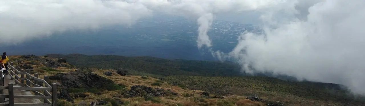
- Weather changes fast. Hallasan creates its own weather — clear at the trailhead can mean clouded summit. Check the forecast morning-of.
- Cash + T-money. Mountain shop and parking lots are mixed; have your T-money card ready for buses.
FAQ
Which Hallasan route is best for first-timers?
Yeongsil — best views, no permit needed, half-day commitment.
Can I see the summit crater without hiking the full summit route?
No. Only Seongpanak and Gwanumsa reach the crater. The other two stop at Witseoreum (1,700m).
Do I need a guide?
Not strictly. Trails are clearly marked. But guided tours handle the permit booking and trailhead transport — useful if you don't speak Korean.
What's the best season to hike Hallasan?
April–May and September–November are ideal (mild temperatures, clear visibility). Winter hiking is spectacular but technical (crampons mandatory).
How much does Hallasan cost?
Trail entry is free. Parking is ₩1,800. Permit is free. Total cost is just transport + food.
Can I camp on Hallasan?
No. Overnight stays are not permitted in the national park. All hikers must be off the mountain by sunset.
More Jeju Travel Guides
- Jeju Island Complete Travel Guide
- Jeju Oreum (Volcanic Cone) Hiking Guide — easier hikes if Hallasan is too much.
- Best Beaches in Jeju — recovery after a long hike.
- Where to Stay in Jeju